(Highest res.: jpg, 618 x 421 pixel, 72 dpi, file size: 93 KB)
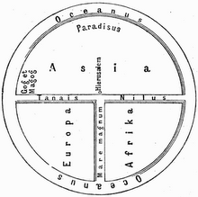
Cartography is an integral part of human history since more than 8000 years. From cave paintings to ancient maps of the Old World, through the Age of Exploration, and on into the 21st century, people have made and used maps. This is a collection of historical world maps describing the known world in their time and at their state of knowledge.


