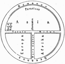
This Roman map of the acient world shows the road network in the Roman Empire in the 4th century and covers Europe, parts of Asia (India) and North-Africa.
 (Highest res.: jpg, 21657 x 930 pixel, 75 dpi, file size: 7,62 MB)
Detail with Rome

(Highest res.: jpg, 746 x 970 pixel, 75 dpi, file size: 257 KB)