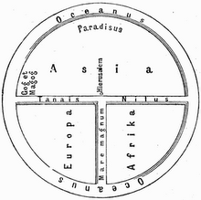
Description: World map from the French cartographer Nicholas Desliens, published in 1566, showing the world upside down.
(Highest res.: jpg, 2496 x 1504 pixel, 72 dpi, file size: 1,22 MB)
Wednesday, December 26, 2012
Thursday, December 13, 2012
World Map 19th Century
Description: World map from the German cartographer Christian Gottlieb Reichard published in "Stieler's Handatlas" in 1891.
(Highest res.: jpg, 4999 x 4200 pixel, 96 dpi, file size: 5,1 MB)
(Highest res.: jpg, 4999 x 4200 pixel, 96 dpi, file size: 5,1 MB)
Labels:
19th century
Subscribe to:
Comments (Atom)


