~~~~~~~~~~~~~~~~

Sunday, April 29, 2007

World Map 18th Century

Description: World map of the Turkish encyclopedist Ibrahim Hakki Erzurumi published in 1756.


(Highest res.: png, 357 x 573 pixel, 199 dpi, file size: 599 KB)

Wednesday, April 25, 2007

World Map 2nd Century

Description: Ptolemy world map ca. 150 AD. Claudius Ptolemaeus (Ptolemy), was a mathmatician, geographer, astronomer and astrologer who lived in the Hellenistic culture of Roman Egypt. One of his main works is his Geographia, a compilation of the known geography in the Roman Empire. This map is a reconstruction made in the 15th century.

(Highest res.: jpg, 1344 x 915 pixel, 200 dpi, file size: 810 KB)

Tuesday, April 24, 2007

World Map 16th Century

Description: The world map of the Spanish cartographer, conquistador and explorer Juan de la Cosa created in 1500 is the earliest world map showing part of the Americas. Juan de la Cosa sailed the first 3 voyages with Columbus and was the captain of the Santa María.


(Highest res.: jpg, 1163 x 2127 pixel, 200 dpi, file size: 3,3 MB)

Monday, April 23, 2007

World Map 12th Century

Description: World map made by the Arab cartographer and geographer Abu Abd Allah Muhammad al-Idrisi in 1154 under the court of King Roger II of Sicily.


(Highest res.: jpg, 1424 x 1552 pixel, 72 dpi, file size: 916 KB)

World Map 15th Century

Description: World map made between 1457 and 1459 by the Venetian monk Fra Mauro. The map is a circular planisphere drawan on parchment and set in a wooden frame.


(Highest res.: jpg, 1062 x 1107 pixel, 180 dpi, file size: 990 KB)

Detail Europe


(Highest res.: jpg, 600 x 415 pixel, 324 dpi, file size: 131 KB)

World Map 15th Century

Description: The Kangnido Map created in Korea in 1402 is one of the oldest known world maps from East Asia.


(Highest res.: jpg, 600 x 556 pixel, 96 dpi, file size: 81,1 KB)


(Highest res.: jpg, 775 x 720 pixel, 96 dpi, file size: 97,2 KB)
Details
(Highest res.: jpg, 779 x 720 pixel, 96 dpi, file size: 91,1 KB)

World Map 17th Century

Description: World map published in 1627 by the German mathematician, astronomer and astrologer Johannes Kepler.


(Highest res.: jpg, 1776 x 1056 pixel, 1350 dpi, file size: 555 KB)

World Map 14th Century

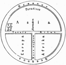
Description: The Hereford Mappa Mundi is a world map dating to ca. 1300, derived from the T and O maps and the largest known medieval map.


(Highest res.: jpg, 4200 x 4989 pixel, 96 dpi, file size: 11,1 MB)

Detail showing the British Isles


(Highest res.: jpg, 1407 x 1146 pixel, 72 dpi, file size: 380 KB)

World Map 16th Century

Description: World map published by Nicola van Sype in 1581, showing the Drake circumnavigation 1577-1580 as a dotted line.


(Highest res.: jpg, 4000 x 2225 pixel, 80 dpi, file size: 7,75 MB)

World Map 16th Century

Description: Bunting clover leaf map with Jerusalem in the center, sourrounded by Europe, Asia and Africa, published 1581 in Magdeburg/Germany.


(Highest res.: jpg, 4441 x 3496 pixel, 72 dpi, file size: 14,3 MB)

World Map 18th Century

Description: World map published by Vasily Kipriynov at the beginning of the 18th century.


(Highest res.: jpg, 563 x 477 pixel, 72 dpi, file size: 130 KB)

World Map 17th Century

Description: World map created in 1689 by the Dutch cartographer Gerrit van Schagen.


(Highest res.: jpg, 4560 x 3936 pixel, 150 dpi, file size: 8,58 MB)